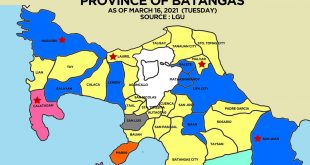
Visit the Calaca, Batangas page for all information on Calaca.
POLITICAL SUBDIVISION
Congressional District: 1st District
No. of Barangays: 40
GEOGRAPHY AND LAND USE
Land Area: 11,270.94 hectares
Land Uses
– Agricultural – 87.56%
– Forest – 3.25%
– Residential – 3.52%
– Industrial – 1.70%
– Others – 3.98%
TOPOGRAPHY
Calaca is a coastal town, being bounded by Balayan Bay on the South. It is plain near the shore, gently rolling in the middle and going steep on the northern-most part adjacent to Gulod ng Batulao.
CLIMATE
The Climate in Calaca, Batangas falls under the type 1 – Corona Classification with two pronounced seasons: Wet and Dry.
Wet months – May to October
Dry Months – November to April
Temperature
Average – 21.6 °C
Maximum – 34.8 °C
Mean – 27.5 °C
Warmest Months – March to May
Wettest Months – July to September
MAJOR RIVERS AND LAKES
- Dacanlao River
- Bagong Tubig River
- Cawong River
- Bolbok River
WATER SUPPLY
Major Sources: Shallow Well, Spring and Free flowing
90% of Household Served
91% of Barangays Served
POWER SUPPLY
Existing Electric Cooperative
BATELEC 1
99% of Households Served
100% of Barangays Served
TRANSPORTATION
Types of transportation available – Jeepney, Van and Tricycle
COMMUNICATION
Postal Service – 1
Telephone – 1
Courier – 6
Internet Service Providers – 3
Cell Sites – 3
DEMOGRAPHICS
Total Population as of 2013 census: 70,521
Population Density: 6.4
No. of Households: 14,996
Average Household Size: 4.70
Birth Rate: 22.9%
Death Rate: 0.1%
RELIGION AND CULTURE
Roman Catholic – 96.75%
Iglesia ni Cristo – 0.10%
Other Denominations – 3.15%
Dialects: Tagalog
 WOWBatangas.com Your Source of Great News and Stories from the Province of Batangas, Philippines


