Breaking News

Mabini, Batangas Town Profile – Geography, Population Rate and Income Class Information

Visit the Mabini, Batangas page for all information on Mabini.
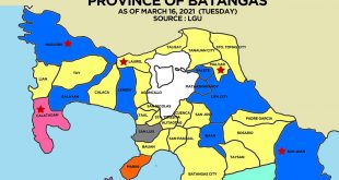
  • Mabini, Batangas is a first class municipality in Batangas.
  • Belongs to the 2nd legislative district of Batangas.
  • It was found on 1923.
  •  
    GEOGRAPHY
    Total Land Area: 44.47 km2 (17.17 sq mi)
    Coordinates: 13°43′N 120°54′E

    DISTANCE FROM MAJOR POINTS
    Manila: 127 kilometers
    Batangas City: 19 kilometers

    LAND USE CLASSIFICATIONS
    Built-Up Areas
    Residential Area – 572.9000
    Commercial Area – 60.8800
    Institutional Area – 26.9120
    Function Open Spaces – 49.2617
    Parks and Playgrounds – 24.8087
    Cemetery – 7.0811
    Dumpsite – 17.3819
    Roads – 184.4900
    Agricultural Areas – 2,441.2776
    Industrial Areas – 413.0404
    Tourism Areas – 326.0576
    Eco-Tourism Areas – 203.2575
    Mineral Areas – 15.6192
    Watershed (source pt.) – 2.3040

    TOTAL 4,296.0000

    BOUNDARIES
    North – Municipality of Bauan
    East – Batangas Bay
    West – Balayan Bay
    South – Maricaban Strait and Municipality of Tingloy

    POPULATION
    Rate as of 2007: 40,629 people in 7,025 households
    Density: 910/km2 (2,400/sq mi)

    Last Updated: September 12, 2013

    About Publisher

    JR Cantos is the Publisher of WOWBatangas.com. Some of the articles here on the website have been contributed over the years, so please just email us at help (at) wowbatangas.com if you have any concerns. Salamat!

    Check Also

    Kakaibang Virtual Graduation sa panahon ng Pandemya

    Dahil sa pandemyang dulot ng COVID19, isa sa lubhang naapektuhan ang sektor ng edukasyon. May …

    Leave a Reply

    Your email address will not be published. Required fields are marked *

    This site uses Akismet to reduce spam. Learn how your comment data is processed.