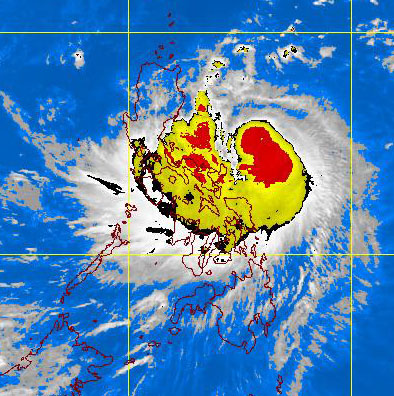
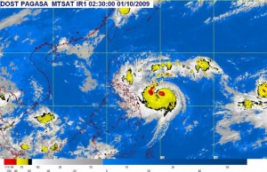
 October 2 Forecast from PAGASA:
The provinces of Catanduanes, Camarines Norte, Northern Quezon, Aurora and Polilio Island will have stormy weather. Northern and Central Luzon and the rest of Bicol region will experience rains and gusty winds with moderate to rough seas. The rest of Luzon and the whole of Visayas will have cloudy skies with scattered rainshowers and thunderstorms. Mindanao will be mostly cloudy with scattered rainshowers and thunderstorms.
Moderate to strong winds blowing from the Northeast to Northwest will prevails over the rest of Luzon and Visayas and coming from the Northwest and west over the rest of the country. The coastal waters along these areas will be moderate rough.
Pagtataya:
Ang kalakhang Maynila ay makararanas ng maulap na kalangitan na may pag-ulan at pagkulog-pagkidlat. Katamtaman hanggang sa malakas na hangin mula sa hilagang kanluran ang iiral at ang look ng Maynila ay katamtaman hanggang sa maalon. Ang tinatayang agwat ng temperature ay mula 24 hanggang 30 antas ng celcius.
Ang probinsya ng Catanduanes, Camarines Norte, Hilagang Quezon, Aurora at Isla ng Polilio ay magkakaroon ng masungit na panahon. Ang hilaga at Gitnang Luzon at ang nalalabing bahagi ng kaBicolan ay makararanas ng pag-ulan at pagbugso ng hangin na may katamtaman hanggang sa maalong karagatan. At ang nalalabing bahagi ng Luzon at ang buong kabisayaan ay magkakaroon ng maulap na kalangitan na may kalat kalat na pag-ulan, pag-kulog at pag-kidlat. Ang Mindanao ay magiging madalas na maulap ang papawirin na may kalat-kalat na pag-ulan at pagkulog-pagkidlat.
Katamtaman hanggang sa malakas na hangin mula sa Hilagang-Silangan hanggang sa Hilagang-Kanluran ang iiral sa nalalabing bahagi ng Luzon at Kabisayaan at magmumula naman sa Hilagang-Kanluran at kanluran ang iihip sa nalalabing bahagi ng bansa. Ang mga baybaying dagat sa mga lugar na ito ay magiging katamtaman hanggang sa maalon.
 According to PAGASA, At 4:00 a.m. today, Typhoon “PEPENG” (PARMA) was estimated based on satellite and surface data at 650 kms East of Borongan, Eastern Samar (11.5°N, 132.1°E) with maximum sustained winds of 150 kph and gustiness of up to 185 kph. It is forecast to move West Northwest at 24 kph.
Forecast: The Eastern section of the country will experience cloudy skies with scattered rainshowers and thunderstorms becoming widespread rains over Bicol Region which may trigger flash floods and landslides. The rest of Visayas and Mindanao will have mostly cloudy skies with scattered rainshowers and thunderstorms. The rest of Luzon will be partly cloudy to cloudy with isolated rainshowers or thunderstorms.
Moderate to strong winds blowing from the North East will prevail over Eastern Luzon, Visayas and Mindanao and coming from the Southwest and south over the rest of the country. The coastal waters thoughout the archipelago will be moderate rough.
Here is the Forecast position outlook from PAGASA.
Friday morning:
220 kms East of Virac, Catanduanes
Saturday morning:
80 kms East of Casiguran, Aurora or
160 kms Southeast of Tuguegarao City
Sunday morning:
60 kms Northwest of Laoag City
Meanwhile, in case of emergency you may contact the following telephone numbers:
NDCC – 9122112
Coast Guard -5278487
MMDA-5277481
Meralco- 6311111
PAGASA- 4338526
Batangas Helpline: 7232568 7234246
[tags]Bagyong Pepeng update, storm signal, signal number 2, PAGASA, contact numbers, telephone number, Batangas Help line, hotlines, NDCC, Storm, Typhoon, Ondoy, report about typhoon Pepeng, Philippines, Flood, News, Manila, Luzon, Batangas, Visayas, Mindanao, Forecast, Sattelite picture, Bagyong Pepeng Signal, SUper typhoon, prepare, disaster, Hotlines, Signal number 1, Signal number 3, Bicol Region, Southern tagalog, Batangas, Central Luzon, Metro Manila, Quezon City, marikina, Pasig[/tags].
 WOWBatangas.com Your Source of Great News and Stories from the Province of Batangas, Philippines


