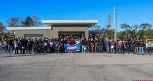
Related Articles

Visit the Balete, Batangas page for all information on Balete.
- Balete is a 5th class municipality in the Province of Batangas, Philippines.
- Belongs to third legislative district of Batangas.
- Founded on 1838.
GEOGRAPHY
Total Land Area: 25.00 square kilometers (9.65 sq mi)
Coordinates: 14°01′38″N 121°05′53″E
Postal Code: 4219
DISTANCE FROM MAJOR POINTS
Lipa City – 15 kilometers
Manila – 93 kilometers
Batangas City – 44 kilometers
TOPOGRAPHY
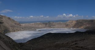
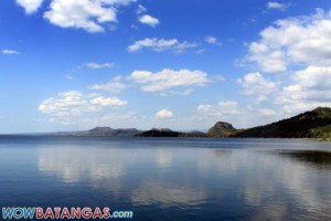
The highest portion of Balete is about 100 – 200 feet above sea level. It has slope of about 40% – 60%. A big portion of Taal Lake is situated within its jurisdiction. It has three tributary namely: Palsara River, Magapi River, and Sampalocan River.
Slope:
0 – 3% (level to very sloping or under lating)
8 – 18% (moderately sloping or strong by rolling)
18 – 30% (strongly sloping or strong by rolling) can be found in certain portion of Palsara, Magapi & Solis.)
50% & above (strongly by hilly & mountainous) can be found in brgy. San Sebastian.
SOIL TYPE
Soil type ranges from clay loam to Lipa loam to sandy loam or Taal loam.
Lipa series – like Ibaan series, Lipa soils are also derived from residential to light brown, yellow, very friable, loose, fine granular loam. Depth is 25 to 30 centimeters. The substratum is light brown tuffacous rock. Lipa loam is found in the northeastern part of the province where Lipa City, M-Kahoy, Malvar and Tanauan are located.
Taal Series – soils of this series are from volcano efits. The surface soil is grayish brown to light gray when dry, dark brown to nearly black when wet. Depth is 30 45 centimeters. The sub-soil is gray to brown, light to grayish brown, loose and structure less fine and to fine sandy loam. Depths 110 to 170 centimeters. The substratum is brown, loose and structure less, sandy loam light gray and or gray sand and or gray volcanic tuff.
Taal series comprise several soil types, more important of which is Taal Loam and which is more widely distributed, bordering the Taal Lake along the western, northern, and North eastern shore.
CLIMATE
Balete belongs to type IV of climate, with two distinct seasons, wet from June to November and dry seasons from December to May Temperature ranges from 70F to 90F, particularly during summer Southwest monsoon wind (Habagat) generally occurs during the rainy seasons.
ADJACENT PLACES / BOUNDARIES
North – Municipality of Tanauan
Northeast – Municipality of Malvar
West – Taal Lake
Southeast – Lipa City
South – Municipality of Mataasnakahoy
POPULATION
Rate as of 2010: 20,214
Source:
http://www.census.gov.ph/sites/default/files/attachments/hsd/pressrelease/CALABARZON.pdf
Last Updated: November 14, 2013